Data Science Usage in Natural Disasters Predictions


Millions of people are affected by natural disasters each year. Wildfires, floods, tornadoes, volcanic eruptions, are just the beginning of a long list of potential disasters. Some can last a few seconds, while others can last for weeks. However, their effects can be felt for decades or even longer, and impact the global economy, infrastructure, agriculture, and human health. The worst part is that the future impact of disasters will grow dramatically due to climate change. Some regions, which previously rarely suffered floods or wildfires, now regularly experience the effects of these natural disasters. Researchers have collected a large amount of data and developed models that predict disasters, but most of these models are far from perfect. For instance, the amount of data that is monitored by satellites and various ground sensors all over the world each minute is incredibly large, and therefore presents a major challenge for researchers. Having lots of information can be an asset, but data requires computational resources. As more data is collected, computational models become increasingly complex and slow. Furthermore, since just a few minutes’ notice in advance of a flood or wildfire can save people’s lives, predictive models must be able to work and do corrections in real time. Artificial Intelligence (AI) techniques and approaches, like data mining, machine learning, and deep learning, can assist in disaster prediction. It is possible for AI to find hidden dependencies in data, which can be a basis for better understanding the mechanism of disasters, and, as a result, making better predictions. Good predictions and warnings reduce economic losses and save lives. We can’t stop most disasters, like floods, hurricanes, volcano eruptions, but we can be prepared for them. In this article, we will illustrate how data science can help in predicting different natural disasters.
Wildfires
Most countries all over the world are faced with uncontrolled fires in rural areas. We can even say that there is always an uncontrolled fire taking place somewhere on Earth. Of course, there are some regions that are more sensitive to wildfires, and thus, their climate dynamics contain fire seasons. If this is not taken into account, the consequences can be horrible. Wildfires are very destructive in many ways.
- Thousands of square kilometers of forests are burned each year only in the USA. 17,939 square kilometers were burned in the USA from January to September of 2019.
- Wildfires generate large amounts of smoke pollution. Fire emissions include carbon dioxide, carbon monoxide, organic chemicals, nitrogen oxides, and atmospheric mercury. Smoke can travel hundreds of kilometers and impact the health of millions of people. Another danger factor is that a big fraction of smoke consists of greenhouse gasses.
- Wildfires affect infrastructure, agriculture, and humans’ lives. They cause billions of dollars in losses every year. During summer-fall 2018, wildfires in California were responsible for 106 deaths. Furthermore, during this period, the total financial cost of these disasters in California amounted to $24.5 billion.
The spread of a fire is hard to predict and control. It depends on multiple factors, such as wind, topography, humidity, and complex fuel structures. Complex meteorological scenarios can cause an almost instantaneous change to the direction in which a fire is spreading. Thus, modeling and predicting wildfire behavior requires collecting a huge amount of data in real time. This is a serious computational challenge for researchers.

1 Data Science Usage in Natural Disasters Predictions
Artificial Intelligence technologies, such as Big Data, Data Mining and Machine Learning (ML), may be implemented into existing physics-based models. Alternatively, they may become a basis for new wildfire prediction systems. It is worth noting that such systems already exist; using adopted Artificial Neural Networks (ANN) and Support Vector Machines (SVM), they predict the spread of wildfires. Most of them use various data sources received from meteorology stations, satellites, and individual cameras. A predictive model uses satellite images and individual cameras to recognize a wildfire. Then, meteorology and topography data are used to predict the spatial spread of the fire. The result of the prediction is a 2D vector that describes a fire’s perimeter at specified time intervals. This 2D vector can be easily visualized.
So, fire managers can use it in order to plan work to be executed by firefighters, as well as the evacuation of the area’s residents. The accuracy of such predictive systems is different and depends on the specific ML approach being used, the complexity of the meteorological scenario, and the region specification. For example, the FireCast system has an average accuracy of 87.7% and recall of 91.1%.
Earthquakes
Unlike other natural disasters, earthquakes are very difficult to predict, because there is no particular mechanism for their prediction.
Earthquake lethality and destruction rates are very high. The total number of deaths caused in the last decade is higher than 1.5 million. In the United States alone, earthquakes cause millions of dollars in insured losses per year.
The appearance of earthquakes is caused by movement of the tectonic plates. The crust of our planet consists of huge tectonic plates. High stress occurs in the places where these plates connect. During an earthquake, the stress becomes critically high, and the high elastic energy releases. That energy causes destruction and fault ruptures of rocks. Some part of the energy transforms into vibrations, called seismic waves. The waves reach Earth’s surfaces and cause vibrations of soil, some of which are destructive. Intense ground shaking can generate landslides, surface faulting, tsunamis, floods, and soil liquefaction. Earthquakes may last from seconds to minutes.

2 Data Science Usage in Natural Disasters Predictions
Not all earthquakes have a natural origin; some forms of human activity - e.g. oil drilling, coal mining, etc. - can also produce earthquakes.
Researchers collect huge amounts of seismic data in different regions. Nevertheless, modern models can describe earthquakes but cannot predict them. The occurrence of earthquakes seems quite random. Still, in recent years, Artificial Intelligence algorithms have come to help seismologists. Machine learning methods allow researchers to detect some hidden patterns of periodicity in earthquake occurrences. This method was applied to the Geysers geothermal field in California. Data clustering by Convolutional Neural Networks of 46,000 earthquakes in that region shows clear temporal patterns. This knowledge helps to detect changes in seismic sources.
Another way Machine Learning can be useful is with localization of earthquakes. ML has been used to create models based on Convolutional Neural Networks, in order to predict earthquake localization in West Bohemia and aftershock locations in Kobe, Chi-Chi, and Kashmir. The accuracy of these models is close to 90%, with a low value of false positive detections (false detection of an earthquake is a serious matter, as it can induce panic).
Hurricanes
The 2019 Hurricane season in the USA has traditionally caused billions of dollars in losses. Hurricanes are ocean-bred storms that appear in midsummer through late fall (in the case of Atlantic hurricanes). The wind speeds in hurricanes vary from 119-153 km/h (Category 1) to >252 km/h (Category 5).

3 Data Science Usage in Natural Disasters Predictions
There are two possible methods for hurricane prediction:
- The first is related to predictions of hurricane occurrence. Data scientists use historical data about previous hurricane seasons in order to predict the number of storms, and their intensity. Statistical methods can provide information regarding approximate wind speeds and the intensity of sustained winds. Unlikely, the accuracy of these predictions is not very high.
- The second is responsible for tracking of a current hurricane. Satellites, like GOES (the Geostationary Operational Environmental Satellite), record images of the Hemisphere every five minutes. These images of existing hurricanes provide information related to its activity. Then, deep learning algorithms detect the eye of a hurricane. Long-wave radar data and satellite data are combined in order to develop a predictive model. There are several widely used models; the European Center for Medium Range Weather Forecast (ECMWF) model and the National Weather Service’s Global Forecast System (GFS) models are prominent examples. Usually, predictions of a hurricane’s path apply for a period of 3-5 days. The accuracy of such predictions decreases with time.
A Hurricane forecast is crucial to preparing people in high-risk regions and organizing evacuations from high-risk regions.
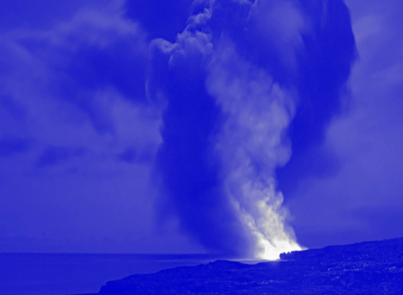
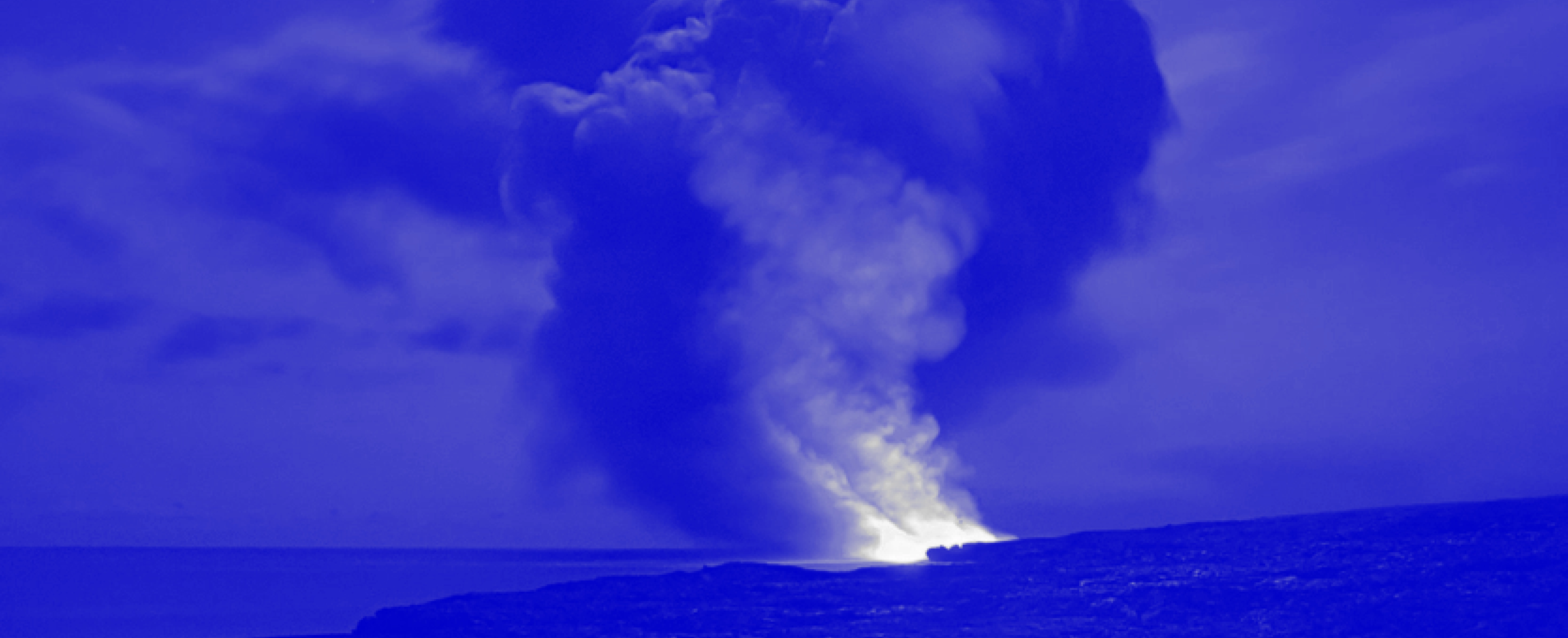
Volcanic Eruptions
People have lived near volcanoes since ancient times. There are always a dozen or more volcanoes in active state. Their activity ranges from gas-and-ashes plums to lava flows. So, scientists are constantly working on methods to effectively predict volcanic eruptions.

4 Data Science Usage in Natural Disasters Predictions
1,500 volcanoes are constantly being monitored. The monitoring includes many factors:
- Earthquakes. Seismic data, such as the number and size of earthquakes taking place, is recorded. This is important information to because, due to the fact that volcano eruptions produce a sequence of earthquakes before an eruption occurs in the vicinity of the volcano.
- Gas emissions. Sulfur dioxide (SO2) gas begins to escape when its pressure increases when magma is close to the surface. Measurements regarding concentrations of SO2,CO2/ SO2ratio, and hydrochloric acid provide information of volcano activity.
- Remote monitoring. Satellite technology allows us to monitor some important data about volcanoes. Satellite sensors offer useful information pertaining to some volcanic gases, thermal signatures, cold eruption clouds, ground deformation, etc.
- History of volcanic activity is also important in building predictive models.
The large amount of data being handled and the need for real-time monitoring require the assistance of artificial intelligence technologies. An example of such assistance is the MOUNTS platform (Monitoring Unrest from Space). This platform uses multisensor satellite-based imagery (Sentinel-1 Synthetic Aperture Radar SAR, Sentinel-2 Short-Wave InfraRed SWIR, Sentinel-5P TROPOMI), ground-based seismic data (GEOFON and USGS global earthquake catalogs) and provides real-time access to these sources. The Trained Artificial Neural Network detects strong deformations in the interferograms generated by the system. The MOUNTS platform informs researchers about volcanic activity in real-time.
Floods
Floods are a common natural disaster. There are a variety of reasons for the occurrence of floods, from rivers swollen by heavy rains to storm surges. Like other disasters, their ecological impact can last for decades or longer.

5 Data Science Usage in Natural Disasters Predictions
Forecasting flooding events requires several types of data:
- The amount of rainfall. Real-time monitoring of rainfall amounts provides valuable information regarding flood risks.
- The rate of change in a river or sea stage helps to indicate the severity and immediateness of the disaster. Also, it is important to know how strong the stream of the river is.
- Data about a river’s drainage basin, such as soil-moisture conditions, ground temperature, snowpack, topography, and vegetation cover.
- Knowing a storm’s path, and its intensity, is important for the regions close to the sea during hurricane seasons.
- Satellite images and aerial photography. Image processing gives researchers greater knowledge about flooded areas, such as how much water runs off, where it runs to, how wide an area is flooded, and the dynamics of a given flood.
Deep learning techniques and applications based on artificial intelligence can process different types of data, predict flood dynamics in real-time, and can keep people updated with the latest critical information about the disaster.


Interesting For You


Real Life Data Science Applications in Healthcare
Due to healthcare's importance to humanity and the amount of money concentrated in the industry, its representatives were among the first to see the immense benefits to be gained from innovative data science solutions. For healthcare providers, it’s not just about lower costs and faster decisions. Data science also helps provide better services to patients and makes doctors' work easier. But that’s theory, and today we’re looking at specifics.
Read article


How Can Data Science Help My Organization?
Nowadays, there is a tendency to hire data scientists or even form data science groups in companies. This does not only apply to specific activity sectors or large organizations. Small and midsize businesses are more frequently involving data scientists, in order to get actionable insights from collected information. So, how does data help to run and grow everyday businesses? There are several areas where collected data and the insights drawn from that data can have a significant impact on business.
Read article

Predictive Analysis in Business
Decision-making in business is often based on assumptions about the future. Many companies aspire to develop and deploy an effective process for understanding trends and relationships in their activity in order to gain forward-looking insight to drive business decisions and actions. This is called predictive analytics. We can define predictive analytics as a process that uses data and a set of sophisticated analytic tools to develop models and estimations of an environment's behavior in the future. In predictive analysis, the first step is to collect data. Depending on your target, varied sources are using, such as web archives, transaction data, CRM data, customer service data, digital marketing and advertising data, demographic data, machine-generated data (for example, telemetric data or data from sensors), and geographical data, among other options. It is important to have accurate and up to date information. Most of the time, you will have information from multiple sources and, quite often, it will be in a raw state. Some of it will be structured in tables, while the rest will be semi-structured or even unstructured, like social media comments. The next important step is to clean and organize the data - this is called data preprocessing. Preprocessing usually takes up 80% of the time and effort involved in all analysis. After this stage, we produce a model using already existing tools for predictive analytics. It is important to note that we use collected data to validate the model. Such an approach is based on the main assumption of predictive analytics, which claims that patterns in the future will be similar to the ones in the past. You must ensure that your model makes business sense and deploy the analytics results into your production system, software programs or devices, web apps, and so on. The model can only be valid for a certain time period, since reality is not static and an environment can change significantly. For example, the preferences of customers may change so fast that previous expectations become outdated. So, it is important to monitor a model periodically. There are plenty of applications for business based on predictive analytics. To conclude this article, we will briefly consider some of them.
Read article